Monday, May 18, 2020

2020 Crowdfunding Update #3

Shepperd's Dell Falls and Bridge
Shepperd's Dell State Natural Area. Oregon.
April 18, 2014
https://sites.google.com/site/recreatingthehcrh/historic-columbia-river-highway/shepperds-dell/shepperds-dell-trail

Heading into the final week or so of the website rebuild (
www.RecreatingTheHCRH.org), I am finding myself in a position where I need to pass the crowdfunding hat around again to see this work through to the end. (https://www.gofundme.com/f/recreatingthehcrh)

Due to the Covid-19 shutdowns, I ended up having a lot more time to work on the website than I originally expected, and I was able to accomplish a lot more with a lot less income over the last couple months. Because of this, instead of just repairing the site, I was able to add a significant amount of new content as I worked through the pages, and the site is a lot larger, more detailed and, hopefully, a bit easier to navigate than it ever has been before.

Since the fundraiser started, I’ve put in 577 hours, averaging 47 hours per week, and repairing, updating, and/or creating over 800 web pages full of history, maps, photos and information on the Columbia River Highway. I truly hope this is becoming, as highway expert Kirk J. Poole suggested, “the encyclopedia of the highway” and “the most seminal work” on the CRH “in the past 50 years.”

Now that the world seems to be slowly resuming, it is time for me to wrap this phase of the project up as quickly as possible. Moving ahead, after the rebuild is done, there will still be new content being added to the site on a regular basis, more photos, current and past, more stories and histories to be explored, more field work to be done and, hopefully, a lot more video being produced. However, that will be part-time work on the side for me, not full-time work as the site rebuild has been.

So, to everyone who has been able to contribute so far, I thank you very much. The work done so far would not have been possible without your support, and for those who haven’t yet, if you enjoy the content on the Recreating the HCRH Facebook Page (https://www.facebook.com/RecreatingTheHCRH) and / or the website, I’d ask you to consider throwing a few bucks towards supporting this work. Every little bit helps a lot!

Please check out the website, and I’d love to hear any feedback. It is complete from Seaside to Lindsey Creek now and, for a few more days, a bit more hit and miss after that.  You can go directly to the site and explore (www.RecreatingTheHCRH.org) or go to the progress spreadsheet and click the links to see the recently repaired and updated pages (https://docs.google.com/spreadsheets/d/1JRWxizJp1E6rxhj8Ak4o9BX4F4ugiNIPNzlyJcuYlRM/edit?usp=sharing).

And, once again, here is the link to the crowdfunding campaign: 

Thanks to everyone for all of your support and participation in this project!

Sunday, March 29, 2020

2020 Crowdfunding Update #2


Moving ahead into this last week of the month, I wanted to remind folks that the crowdfunding campaign is still going on, and I could really use a little support right now since this is my only source of income for the moment.


GoFundMe Link: gf.me/u/xmar2w

I backed off on promoting the crowdfunding campaign for a bit. With the Covid-19 outbreak, I've had plenty of time to work on the website, and am very near completing the rebuild of the Lower Columbia River Highway segment, and have completed a significant amount of the work on the HCRH and Upper Highway Sections.

I am hoping to get the primary rebuild done by the end of the week and to be able to just focus on new content moving ahead after that (and I've got a ton of great stuff on deck that I can't wait to share!). With the extra time that the current situation is offering, I took some extra time on the Lower Highway section to add A LOT of new content while rebuilding that part of the site. Please check it out: 

https://sites.google.com/site/recreatingthehcrh/lower-columbia-river-highway

Since the crowdfunding campaign began, I've put in 262 hours on this project, and the website is not only getting repaired, but updated and reorganized, and will, hopefully, be much more user friendly experience moving ahead. My daily, page by page, progress can be tracked here: 


Thanks to everyone who has donated! Even with the extra time this crisis has brought, this work still would not have been possible without the donations made so far! 

Moving ahead, I really do not want anyone to donate if they are feeling like they not surviving financially through these uncertain times, but if you are able to help out at all, it would be greatly appreciated. My finances have been way scaled back, so only a few dollars will go along way towards making it through the next month. Even five bucks will go a long way for me right now.

Wednesday, March 25, 2020

Chasing down red herrings: Paradise Lane & McKay Drive

Spent way too long today chasing down these red herrings, but I did finally get them ruled out by the 1928 Metsker map that shows the CRH running on the west side of the tracks through here.

True, this could be a remainder of the pre-1920-ish Portland Road through here, so later research may put this page back up on the site.  If not, it will live here as an "early draft."


PARADISE LANE & MCKAY DRIVE

Route 2

Ruled Out


March 25, 2020
I'll probably just delete this page after ruling out McKay Drive, but it does provide an interesting look at the process I use on charting out the original highway, starting with Google Earth and lidar (if applicable) to identify likely suspects and to plan future field trips to confirm or reject the grades and roads as old CRH. Left out of the process, here, is looking at period maps, but those are not easily accessible to me at the moment.

Originally, I mapped out the major surviving fragments by just getting out on the highways and driving, spotting the roads and exploring. The major sections of the old route are pretty obvious if you know what to look for.

It's these sorts of bits and pieces fragments around the new and improved modern highways that are a lot more difficult to sort out.

Tiny section of possible old pavement on Paradise Lane (v.007) Google Earth Imagery Date: May 8, 2019

Above, there is a very interesting looking patch of possible old pavement on Paradise Lane, just west of W. Lane Road that I spotted while looking for Taylor's "Mile 22.8" fragment on Google Earth.

However, a quick look at the location in Google Street View almost immediately rules it out. Clearly, the grading shows that this is overflow parking for the church and not a relic of the original highway.

Paradise Lane suspect in Street View Google Street View Imagery Date: July 2018

I am only mentioning McKay Drive, which I wondered about long before spotting the Paradise Lane pavement, as a rule out. The south end, before the curve, is a better possibility than the north end, after it curves away from modern US 30 to meet with W. Lane Road.

Modern US 30 between Scappoose and the Old Portland Road into St. Helens feels way too straight for me. On the other hand, Old Portland Road itself, which is confirmed to be original highway, is pretty straight too.

Also, I am not seeing any clear paths for the original alignment coming into the north end of this short road.

Bottom line, McKay Drive is probably not original CRH, but I still want to check it out on the ground before I rule it out.

The south end makes this road look likely, but the north end goes no where... (v.007) Google Earth Imagery Date: May 8, 2019
A final possibility here comes from looking at the alignment of the south end of McKay Road, Paradise Lane, and the road on the highway side of the cemetery just south of Honeyman Creek (below).
McKay Drive. Probably not CRH, but curious enough to need to be ruled out (v.007)
Google Earth Imagery Date: May 8, 2019

While I suspect that if these were all parts of the original highway they would remain connected as a continuous frontage road, who know? Stranger things have happened over the years, and it is all worth checking out on the ground, making a few quick stops on the way west to more certain territory.

Cemetery and Honeyman Creek (v.007)  Google Earth Imagery Date: May 8, 2019

Saturday, March 14, 2020

Delena, Oregon

Text from the old Delena page on the website, I am preserving this here because I want to, after the rebuild, check with Pamela and see if she still has the Panoramio photos.  These links are all dead since Google discontinued that service.


Old Delena School (2010)
Photo by Pamela Elbert Poland
http://www.panoramio.com/photo/41116710
Since 2010, the roof has been replaced. 

Old Delena School, Re-purposed With New Roof (2015)
Delena, Oregon. Columbia River Highway. May 9, 2015
Copyright © 2015 A. F. Litt, All Rights Reserved
Another good 2010 photo of the old Delena School, 1922, by Mark Zemlin on Panoramio: http://www.panoramio.com/photo/33457622

The Ghost Town of Delena is right here, but other then piles of 1970’s logging equipment there is little interesting to see.

Pacific Northwest Photoblog: Beaver Falls – Clatskanie Oregon

http://pnwphotoblog.com/beaver-falls-clatskanie-oregon/

Hudson School

Another old school, now re-purposed as a church.  It's a little bit off the old highway.

2010 Photo: http://www.panoramio.com/photo/41116316

I spent 4 years at Hudson School, which is off the old highway. It's now a church and they did some remodeling on it that totally changed its look. 

 [It closed] ...after they built the new school complex (which is on the old highway), which opened in the fall of 1978. They consolidated Hudson and Delena and put them in the new school called Hudson Park Elementary. I moved away from the area in 1984, so it was after that the grade school downtown was also closed and the kids moved up to the newer school.

Pamela Elbert Poland. Facebook Comments. May 23, 2015

I attended school here from October 1966 until June 1970, grades 1 through 4.

Pamela Elbert Poland. Panoramio.  September 22, 2010

http://www.panoramio.com/photo/41116316

Saturday, February 29, 2020

2020 Crowdfunding Update #1

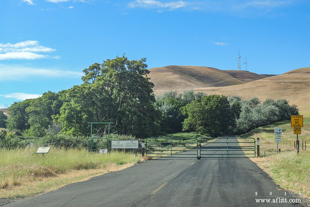
Abandoned Columbia River Highway fragment in Gilliam County

So we're a few days into the campaign and have reached 10% of the goal.  A nice start!  Thank you very much to those who have contributed so far, it is very much appreciated.

I'm planning on running this sort of like a pledge drive on PBS/NPR, so I'll be bugging folks every day or so on Facebook as this project continues.  If you have already contributed, I apologize in advance for this!

So far, I've been able to start getting some time in today on repairing some old pages.  I'll be posting links as I continue.  Today's work was made possible by the contributions received so far, so things are going well!

And, as always, every little bit helps, so please consider contributing so we can get this website up and running again, so it once again can be a useful asset for everyone interested in the history of the old Columbia River Highway!

GoFundMe: gf.me/u/xmar2w

Thursday, February 20, 2020

2020 Fundraiser: Rebuilding the Columbia River Highway Website

Elowah Falls, June 16, 2015
Filming for #recreatingthehcrh

To help rebuild the website, please visit: https://www.gofundme.com/f/recreatingthehcrh


With new construction of the State Trail on the horizon, and the new research coming in from Kirk Poole's awesome Past and Present Views Along the Columbia River Highway Facebook Group, it is time to return this much appreciated resource to a usable state.

Originally, I built this site while I was a stay-at-home father and had a lot of time to work on it, but now it is a very part time job and, at the current rate, documenting new research and repairing the old pages, it will take about two years to complete this work.

Because of this, I've decided to try a bit of crowdfunding to speed the job up. My day job work is very slow right now, and this would be an ideal time for me to work full time on the website for several weeks. 

So, my fundraiser is going to be for covering time and expenses for full time work on the website, and to help fund some new research. How much I can get done and how quickly will depend on the response to the campaign. 
 
If fully funded, I plan on getting the site fully restored by the end of March. However, any contributions will help. 

Overall, this project has been a seven-year labor of love and I have resisted seeking donations in the past, but as circumstances change, I am realizing that I need some help to get this work done.
Once the site is rebuilt, I will also be able to focus more on research and video production, on new content instead of just repairing old content. While I am not sure if a feature length documentary and book are still in the works, time will tell, I do want to resume producing video shorts and fleshing out the history of the highway in more detail on the website.

If you have appreciated the content on the website, the associated Facebook Page (https://www.facebook.com/RecreatingTheHCRH), and/or the YouTube Channel in the past, I'd ask you to consider contributing to this fundraiser. Any amount will help, and I thank you for taking the time to consider helping with this cause.

One way or the other, work will continue on the site and I look forwards to continue sharing the history of the highway with everyone!

To help rebuild the website, please visit: https://www.gofundme.com/f/recreatingthehcrh

Saturday, January 18, 2020

Dead Blog Photos

Too much of this!
(Yes, I know, too meta, a working image of a non-working image...)

Unfortunately, the devastating data losses a few years back that killed off most of the photo links on the website also killed off a lot of them here on the blog. 

And this!
My focus is going to be on rebuilding the website, not the blog, but if there are specific images here that you would like to see, let me know which image and which post and I will see what I can do! know!

Email me at aflittcreative@gmail.com

Hello 2020: Work on Recreating the HCRH Resumes!

Columbia River West to Ruthton Point
Ruthton Park. Hood River, Oregon.
April 25, 2013

It's Saturday, I've been down with the flu for a week and a half, and I've got a lot on my plate that I want to accomplish today with the HCRH project, but before diving in I wanted to do a quick overall project update (mostly to help sort out my own thoughts on how to move ahead).

Looking back at the videos from 2015 (a half-decade ago!), you'll see that there were ambitions for this project that were clearly never met. Without going into detail, let's just say a lot of life happened right as I was gearing up for production on the feature-length documentary in late 2015 and those next few years were difficult years, to say the least...


Very little creative work on anything was possible during that time, and there were a lot of setbacks involving the work already completed on the film. Data loss on the website, requiring the rebuild I am currently working on, lost footage and stills, which may be recovered in the future, the fate of those hard drives is still undetermined... Heartbreaking, since a lot of that material is irreplaceable due to construction of the HCRH State Trail in the Gorge and to the general passage of time. There was also a significant loss of gear and equipment that made further progress on the film impossible at the time...

Anyway, life is much better now and, while I was unable to meet the 2016 goal for the movie and the 2018 goal for a book, I did get a book out in 2019! It just had nothing to do with the highway, was fiction, and was written by someone else! That work took almost all of 2019 to complete, further delaying this project, but it is work that I am very proud of.

Upon publication of The Yellow Painted Man last year, after a brief break, it is now time to return to the highway. This return has been further motivated by the excellent work Kirk J. Pool and several other folks have been doing recently documenting the Lower Highway (including the first decent explorations of the Bagby Loops that I know of!). Their work can be followed on the US 30 Remnants from Astoria to Eastern Oregon group on Facebook (https://www.facebook.com/groups/483015922488601). It is an excellent group and definitely worth joining if you enjoy the exploring the history of the highway.

So, now it is 2020 and I've started rebuilding the website. For now, that is going to be my primary goal. Movies, books, whatever... It all needs to start with getting the site back up and running, so that is all that I am going to worry about at the moment. After that, we'll see what life holds.

Recreating the HCRH: "New" Website
January 18, 2020
https://sites.google.com/site/recreatingthehcrh/home

I will say, this project started with researching a planned short film on the original route of the highway (filming on that was mostly completed by the end of 2015), and I really do hope that is where this leads in the end. Whether or not that happens may depend on if the old footage is recovered along with several other factors. Losing that footage is not necessarily a deal breaker, though. Any hesitation I have at this point in declaring the film alive (or, at least, undead) really comes from being a bit gun shy after the setbacks a few years ago.


As for a book, well, that might actually come before the movie now. We'll see how things go. But, as I said, first things first: it all starts with rebuilding the website, a pretty significant project all on its own.

The first stage will be reformatting for the new platform while rebuilding the dead photo links. That, in and of itself, will be a fairly sizable project. I had to do that once before and it took about six weeks of eight hour days to complete. Today, the site is much larger and more complex than it was then and my "free" time to work on this labor of love is much reduced, so just completing this stage of the work may take months.

While rebuilding, I will also be updating the site with new material as it comes up, so there will be some forward motion this year, it all won't just be rebuilding what's been lost.

The second stage, surely occurring, to some degree, concurrently with the first step, will be filling in gaps in my research and "completing" the site per my original goals for it.

After that, we'll find out what seems to be the best way to proceed.

This project has always been a fun adventure, and I look forward to moving ahead with it, whatever the future may hold!

Tuesday, November 22, 2016

Project Update: 2016 is almost over, but the project is still alive...

Filming for #recreatingthehcrh

A photo posted by A. F. Litt (@aflitt) on


Life is messy and strange, and this year has been more messy and strange than most... 

As most people who follow this project have probably noticed, things have been on hold for about a year now.  This project is a labor of love, done in my free time, funded out of my own pocket, and, this year, I could make very little progress.  Clearly, the documentary will not be completed this year, and even the shorts and website have been on hold.  I did film several of the Centennial events, but outside of this, other than sharing relevant posts on Facebook, I was not able to accomplish much this year.

This is a bit more of a personal post than I usually make with this project.  However, I know some folks have some questions, and I do want to assure everyone interested in the history of the highway that I am far from being done with this endeavor.  I am not quitting or giving up. 

I still look forward to completing the film, to fleshing out the history on the website, and to documenting the completion of the state trail, but these goals are pushed back a bit due to the complexities of life…  2016 has been a difficult year filled with major changes in my life. 

So, where do we go from here? 

Over the next few months, I do hope to start releasing some new “web series” shorts and to flesh out the website a bit more.  I’ve got a lot of research and photos waiting go up online.  And there are still some places out on the upper and lower highways that beg for further exploration.  I hope to complete most of that work in early 2017.

After that, I hope to return to work on the documentary.  I’ve not spoken much about this, but the origin of this whole project started with the desire to create a short film exploring the original route of the highway.  Of course, over the years, it has grown into much more.  But the film still is the heart of the project to me.  And I’ve learned so much about the craft of film since this started, and I am so grateful that I’ve had the time to grow in that craft before releasing much video that I’d regret later...

Which also touches on another goal with this film; I truly want this to be a project based in microbudget, Filmmaking 2.0 principals.  Sure, with a ton of money and crew, this film could be made quickly.  And I am sure it would look great and hopefully it would be worth watching.  But when I started this, I decided that I wanted to make this film in a different way, to show what can be accomplished in the medium with non-existent budgets and “prosumer” level gear. 

There have been times when I have been tempted to move back towards a more traditional model on this project, but then I remember what my artistic goals for this film are.  This is not saying that I shun collaboration or help, in fact anyone who wants to help with this is more than welcome, but there is no money to be paid, it’s volunteer work on a labor of love.  So far, I haven’t found many others with the film skills required and a passion for the old highway who’s willing to jump in.  Of course, I haven’t looked that hard, either. The time I've spent on this project so far has mostly been out shooting and exploring, or researching and website building.

Staying true to these goals, though, means that making this film is a very slow process.  A lot, more than a lot, of filming has been done.  Many interviews still need to be done.  And, eventually, in late 2017 or 2018, it all will be done.

Thank you so much to everyone who follows the Facebook page, to everyone who has offered all sorts of help since this all got started back in 2013, and to everyone who comes along in the future.  Things have been a bit slow recently, but will be picking up again eventually, and I hope we can all have a great time together as we see how everything comes together in the end, both for the state trail and for this documentary project.

Saturday, July 23, 2016

Antique Auto Tour on the Columbia River Highway

Rowena Crest, Historic Columbia River Highway (2014)
Columbia River Gorge National Scenic Area.  Oregon.  July 15, 2014.
http://www.aflitt.com/2014antiqueautotour
Copyright © 2014 A. F. Litt, All Rights Reserved
Originally posted on Rubble

Photo of the Day by A. F. Litt: July 23, 2016


Today is the Friends of the Historic Columbia River Highway's annual Antique Auto Tour.  Since it is the centennial of the HCRH this year, instead of back and forth from the Western Antique Aeroplane & Automobile Museum (WAAAM) to Rowena Crest, they will be driving the from Troutdale to the Columbia Gorge Discovery Center today, with a lunch stop at Marine Park in Cascade Locks.

This photo, from the 2014 tour, is not new to the world.  It's been bouncing around for a couple year, but this is the first time it's been featured as a Photo of the Day.


(Yes... If you get to the end, you'll notice that the film has been delayed a bit, and the web shorts have been paused for a bit...)


Links


Friends of the HCRH: 2016 Antique Car Tour

Wednesday, November 18, 2015

Sandy Boulevard


Recreating the Historic Columbia River Highway: Sandy Boulevard from A. F. Litt on Vimeo.

Exploring the Sandy Boulevard, old U.S. 30, alignment of the Columbia River Highway from Milepost Zero in Downtown Portland to the Sandy River Bridge...

RecreatingTheHCRH.org

Music:

"There's Probably No Time" by Chris Zabriskie
freemusicarchive.org/…/03_-_Theres_Probably_No_Time_…
Licensed under a Attribution License.
creativecommons.org/licenses/by/4.0/

"Isolated" by Kevin MacLeod
freemusicarchive.org/…/Kevin_MacLeod/Contem…/Isolated
Licensed under a Creative Commons Attribution License.
creativecommons.org/licenses/by/3.0/

Stark Street - A Rough Draft


Recreating the Historic Columbia River Highway: Stark Street - A Rough Draft from A. F. Litt on Vimeo.


A rough look at the early Stark Street route of the Columbia River Highway from Milepost Zero at Washington and Broadway in Portland to the Stark Street Bridge on the Sandy River...

Music:
"Junction" by Kai Engel
freemusicarchive.org/music/Kai_Engel/Paradigm_Lost/09_-_Junction
Licensed under a Attribution-NonCommercial-ShareAlike License.
creativecommons.org/licenses/by-nc-sa/4.0/

Tuesday, November 17, 2015

Troutdale: Dead Sheep Goo Pit


Yep...
Eastwinds Development will be building a new hotel and community complex on the site of the old Bissinger Wool Pullery. 
The company is voluntarily removing the remains of thousands of dead sheep buried alongside the iconic water tower from the 1930s. 
The pit where Bissinger buried the dead sheep is now covered in dirt and blackberry bushes. Tests revealed that just below the surface of dirt and blackberry bushes, the pit of dead sheep has turned into a kind of goo.
Sheep goo removal to cause big stink in Troutdale
http://www.katu.com/news/local/Dead-sheep-goo-removal-Troutdale-Bissinger-Wool-Pullery-to-cause-big-stink-in-Troutdale-350569311.html


Monday, November 16, 2015

Timelapse: Multnomah Falls to Dodson


The original idea behind this project was to create a timelapse video of the original Route 2 route through the Gorge... While it has grown a long way from that initial idea, it is still something I am working on.

Of course, my eyes blur after watching a timelapse video for more than a minute or so, which is one of the reasons this project grew into a full documentary. To combat that, I am breaking the timelapse into one minute sections, aligned with the sections on the website.

These are a little rough, but they are what they are. I don't want to take the time to really clean them up at this point, I have more interesting films to make about the highway now!

Tuesday, November 3, 2015

Rubble: Oneonta Falls

Rubble: Oneonta Falls: Oneonta Falls (2015)


A. F. Litt: Public - Not On Site &emdash; Oneonta Falls (2015)

Oneonta Falls (2015)
Columbia River Gorge National Scenic Area. Oregon. August 17, 2015
Copyright © 2015 A. F. Litt, All Rights Reserved
#HCRH http://www.recreatingthehcrh.org http://www.aflitt.com


Photo of the Day by A. F. Litt: November 3, 2015
Back on it after being super busy preparing some film festival submissions and fighting the worst cold I've had in years...  Not much time left for anything else between the two!
Just a plain old waterfall shot of Oneonta Falls from last summer.  I'd love to get back there when that thing was really going, but I have no idea how to do that safely!  Makes me cold just thinking about it...

Thursday, October 22, 2015

Rubble: Gasco From the Tracks (2008)

A. F. Litt: Portland &emdash; Gasco From the Tracks (2008)

Rubble: Gasco From the Tracks (2008): Linnton Plant Administrative Building, Portland Gas & Coke Co. Portland, Oregon. April 26, 2008 Photo of the Day by A. F. Litt: Octo...

Wednesday, October 21, 2015

Demolition begins at Gasco

Original post: Rubble: Demolition begins at Gasco

A. F. Litt: Portland &emdash; Gasco Building (2008)

Gasco Building (2008)
Portland, Oregon. April 26, 2008
Copyright © 2015 A. F. Litt, All Rights Reserved


Photo of the Day by A. F. Litt: October 21, 2015

Structural Demolition is beginning today on the Gasco Building.

Save the Portland GasCo Building Facebook Page
facebook.com/savetheportlandhistory

http://www.recreatingthehistoriccolumbiariverhighway.org/lower-columbia-river-highway/portland-lower-highway/gasco-building

#HCRH http://www.RecreatingTheHCRH.org http://www.aflitt.com

It's happening right now! It looks like they are starting demolition of the clock tower on the Gasco buildingGo see...
Posted by PDXccentric Guidebook on Wednesday, October 21, 2015

Monday, September 21, 2015

A short break on the videos

Gated (2013)

You might have noticed that I am taking a little break from video on this project. This is partially because I have been focusing on some research and photo editing and I have only so many hours in the day, and partially because I want to take a look at what direction I want the "web series" to take from here... Short pretty videos that are posted every week or so or a little longer documentary style shorts that come out every two to three weeks?
Surely it won't be all of one or the other, but I am in the process of figuring out which direction I want to go with the video content from here, and there are many factors involved.
I am also taking this time to clear some other jobs that are not related to this project, so I will be able to focus more time on it later this fall and winter.
Thanks to everyone for your support, it means a ton. This is a labor of love for me, but it is amazing and tremendously helpful to have so much support from everyone as I work on this project.
And to be clear, this is not an idle period... Look for a lot of new content appearing on the website over the next few weeks!

Photo: 
Gated (2013)
Maryhill Loops Road, Washington.  May 21, 2013.

Friday, August 28, 2015

Cascade Locks: 2013 Bridge Walk


A quick and dirty video of the 2013 Bridge Walk over the Bridge of the Gods in Cascade Locks.

This event was a part of Cascade Lock's "Historic Highway Revived" festival celebrating the opening of the HCRH State Trail between John B. Yeon State Park and Moffett Creek, completing the trail and highway reconnection between Troutdale and Cascade Locks.

 Filmed on September 15, 2013

This year's event is on Saturday, Saturday, August 29, 2015, from 8:30 am to 9:00 am.

Shot and Edited by A. F. Litt
http://www.aflitt.com

Music:

"Warm of Mechanical Heart" by Kai Engel
Licensed under a C.C. Attribution License.
http://creativecommons.org/licenses/by/4.0/

"River Meditation" by Jason Shaw
Licensed under a C. C. Attribution 3.0 United States License.
http://creativecommons.org/licenses/by/3.0/us/

"Calls and Echoes" by Kai Engel
Licensed under a C.C. Attribution-NonCommercial-ShareAlike License.
http://creativecommons.org/licenses/by-nc-sa/4.0/

Wednesday, August 26, 2015

The Smokiest Day Ever?


Darryl Lloyd sent us this NASA photo of the smoke in the Pacific Northwest on Saturday, Aug. 22, which Darryl described as the smokiest day he's ever seen in the Columbia River Gorge.

Posted by Friends of the Columbia Gorge on Tuesday, August 25, 2015

A photo posted by A. F. Litt (@aflitt) on

A photo posted by A. F. Litt (@aflitt) on

A photo posted by A. F. Litt (@aflitt) on


Here's where the smoke is coming from. Do not call 911 unless you see a fire or something resembling a smoke column.
Posted by KATU News on Saturday, August 22, 2015


Smoke... http://www.intellicast.com/National/Satellite/Visible.aspx?location=USOR0275


NASA photo of smoke over the Pacific Northwest at 2:10pm yesterday.
Posted by William Herold on Thursday, August 20, 2015