Wednesday, November 18, 2015
Sandy Boulevard
Recreating the Historic Columbia River Highway: Sandy Boulevard from A. F. Litt on Vimeo.
Exploring the Sandy Boulevard, old U.S. 30, alignment of the Columbia River Highway from Milepost Zero in Downtown Portland to the Sandy River Bridge...
RecreatingTheHCRH.org
Music:
"There's Probably No Time" by Chris Zabriskie
freemusicarchive.org/…/03_-_Theres_Probably_No_Time_…
Licensed under a Attribution License.
creativecommons.org/licenses/by/4.0/
"Isolated" by Kevin MacLeod
freemusicarchive.org/…/Kevin_MacLeod/Contem…/Isolated
Licensed under a Creative Commons Attribution License.
creativecommons.org/licenses/by/3.0/
Stark Street - A Rough Draft
Recreating the Historic Columbia River Highway: Stark Street - A Rough Draft from A. F. Litt on Vimeo.
A rough look at the early Stark Street route of the Columbia River Highway from Milepost Zero at Washington and Broadway in Portland to the Stark Street Bridge on the Sandy River...
Music:
"Junction" by Kai Engel
freemusicarchive.org/music/Kai_Engel/Paradigm_Lost/09_-_Junction
Licensed under a Attribution-NonCommercial-ShareAlike License.
creativecommons.org/licenses/by-nc-sa/4.0/
Tuesday, November 17, 2015
Troutdale: Dead Sheep Goo Pit
Yep...
Eastwinds Development will be building a new hotel and community complex on the site of the old Bissinger Wool Pullery.
The company is voluntarily removing the remains of thousands of dead sheep buried alongside the iconic water tower from the 1930s.
The pit where Bissinger buried the dead sheep is now covered in dirt and blackberry bushes. Tests revealed that just below the surface of dirt and blackberry bushes, the pit of dead sheep has turned into a kind of goo.
Sheep goo removal to cause big stink in Troutdale
http://www.katu.com/news/local/Dead-sheep-goo-removal-Troutdale-Bissinger-Wool-Pullery-to-cause-big-stink-in-Troutdale-350569311.html
Monday, November 16, 2015
Timelapse: Multnomah Falls to Dodson
The original idea behind this project was to create a timelapse video of the original Route 2 route through the Gorge... While it has grown a long way from that initial idea, it is still something I am working on.
Of course, my eyes blur after watching a timelapse video for more than a minute or so, which is one of the reasons this project grew into a full documentary. To combat that, I am breaking the timelapse into one minute sections, aligned with the sections on the website.
These are a little rough, but they are what they are. I don't want to take the time to really clean them up at this point, I have more interesting films to make about the highway now!
Tuesday, November 3, 2015
Rubble: Oneonta Falls
Rubble: Oneonta Falls: Oneonta Falls (2015)

Oneonta Falls (2015)
Columbia River Gorge National Scenic Area. Oregon. August 17, 2015
Copyright © 2015 A. F. Litt, All Rights Reserved
#HCRH http://www.recreatingthehcrh.org http://www.aflitt.com
Oneonta Falls (2015)
Columbia River Gorge National Scenic Area. Oregon. August 17, 2015
Copyright © 2015 A. F. Litt, All Rights Reserved
#HCRH http://www.recreatingthehcrh.org http://www.aflitt.com
Photo of the Day by A. F. Litt: November 3, 2015
Back on it after being super busy preparing some film festival submissions and fighting the worst cold I've had in years... Not much time left for anything else between the two!
Just a plain old waterfall shot of Oneonta Falls from last summer. I'd love to get back there when that thing was really going, but I have no idea how to do that safely! Makes me cold just thinking about it...
Thursday, October 22, 2015
Rubble: Gasco From the Tracks (2008)

Rubble: Gasco From the Tracks (2008): Linnton Plant Administrative Building, Portland Gas & Coke Co. Portland, Oregon. April 26, 2008 Photo of the Day by A. F. Litt: Octo...
Wednesday, October 21, 2015
Demolition begins at Gasco
Original post: Rubble: Demolition begins at Gasco

Gasco Building (2008)
Portland, Oregon. April 26, 2008
Copyright © 2015 A. F. Litt, All Rights Reserved
Photo of the Day by A. F. Litt: October 21, 2015
Structural Demolition is beginning today on the Gasco Building.
Save the Portland GasCo Building Facebook Page
facebook.com/savetheportlandhistory
http://www.recreatingthehistoriccolumbiariverhighway.org/lower-columbia-river-highway/portland-lower-highway/gasco-building
#HCRH http://www.RecreatingTheHCRH.org http://www.aflitt.com
It's happening right now! It looks like they are starting demolition of the clock tower on the Gasco buildingGo see...
Posted by PDXccentric Guidebook on Wednesday, October 21, 2015
Monday, September 21, 2015
A short break on the videos
You might have noticed that I am taking a little break from video on this project. This is partially because I have been focusing on some research and photo editing and I have only so many hours in the day, and partially because I want to take a look at what direction I want the "web series" to take from here... Short pretty videos that are posted every week or so or a little longer documentary style shorts that come out every two to three weeks?
Surely it won't be all of one or the other, but I am in the process of figuring out which direction I want to go with the video content from here, and there are many factors involved.
I am also taking this time to clear some other jobs that are not related to this project, so I will be able to focus more time on it later this fall and winter.
Thanks to everyone for your support, it means a ton. This is a labor of love for me, but it is amazing and tremendously helpful to have so much support from everyone as I work on this project.
And to be clear, this is not an idle period... Look for a lot of new content appearing on the website over the next few weeks!
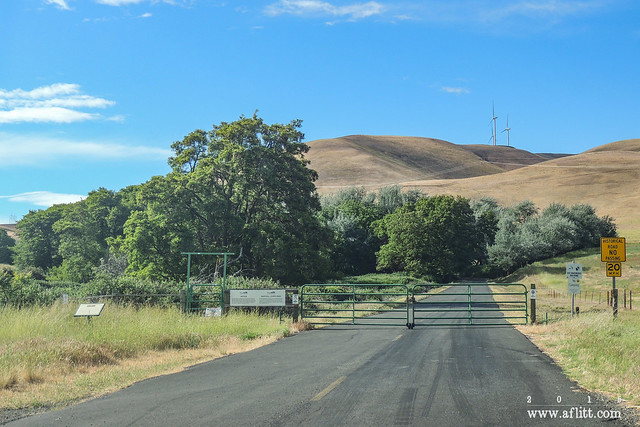
Gated (2013)
Maryhill Loops Road, Washington. May 21, 2013.
Friday, August 28, 2015
Cascade Locks: 2013 Bridge Walk
A quick and dirty video of the 2013 Bridge Walk over the Bridge of the Gods in Cascade Locks.
This event was a part of Cascade Lock's "Historic Highway Revived" festival celebrating the opening of the HCRH State Trail between John B. Yeon State Park and Moffett Creek, completing the trail and highway reconnection between Troutdale and Cascade Locks.
Filmed on September 15, 2013
This year's event is on Saturday, Saturday, August 29, 2015, from 8:30 am to 9:00 am.
Shot and Edited by A. F. Litt
http://www.aflitt.com
Music:
"Warm of Mechanical Heart" by Kai Engel
Licensed under a C.C. Attribution License.
http://creativecommons.org/licenses/by/4.0/
"River Meditation" by Jason Shaw
Licensed under a C. C. Attribution 3.0 United States License.
http://creativecommons.org/licenses/by/3.0/us/
"Calls and Echoes" by Kai Engel
Licensed under a C.C. Attribution-NonCommercial-ShareAlike License.
http://creativecommons.org/licenses/by-nc-sa/4.0/
Wednesday, August 26, 2015
The Smokiest Day Ever?
Darryl Lloyd sent us this NASA photo of the smoke in the Pacific Northwest on Saturday, Aug. 22, which Darryl described as the smokiest day he's ever seen in the Columbia River Gorge.
Posted by Friends of the Columbia Gorge on Tuesday, August 25, 2015
Here's where the smoke is coming from. Do not call 911 unless you see a fire or something resembling a smoke column.
Posted by KATU News on Saturday, August 22, 2015

Smoke... http://
NASA photo of smoke over the Pacific Northwest at 2:10pm yesterday.
Posted by William Herold on Thursday, August 20, 2015
Wednesday, August 12, 2015
Oregon Experience’s documentary “The River They Saw”
A look at the early photographers of the Columbia River Gorge:
Friday, August 7, 2015
Friday, July 17, 2015
New Vimeo Channel!
Started a Vimeo channel for the project. I'll be posting my videos there eventually, but for now I am adding some neat ones from around Vimeo that I've found.
Oregon's Historic Columbia River Highway from Ian Langenhuysen on Vimeo.
Unfortunately, due to throttling issues on my currently free account, it might be awhile before I can get my videos up there, but I will get them up as soon as I can.
CLICK HERE to check out the new channel: https://vimeo.com/channels/recreatingthehcrh
Tuesday, July 7, 2015
Monday, June 22, 2015
Project Update: June 2015
Over the next few months, as what looks to be a very hot summer descends upon the region, I plan on shifting focus away from the website and more towards video content as we move into the last year before the June 2016 centennial.
Of course, work will still continue on the back log of photos still waiting to get posted to the site, and there’s plenty of research notes that will be posted, too, but as I move into more of a full time role on this project over the coming weeks, I see the bulk of my time being spent on video production.
The original goal of this project was to produce a feature length documentary, though over the last couple years, that goal has waffled back and forth a bit between aiming towards a movie, a web series, or a book. All along, I’ve been filming quite a bit, and there’s two years’ worth of video content, with more being produced every month, waiting to get out into the world.
However, after becoming more involved with video production and filmmaking in other areas of my life over the past year, I am now more dedicated than ever to producing a film. Right now the target release date is June 2016. A lot of work will need to happen between now and then to make this a reality, but a lot of work has already been completed, and I am confident that this goal can be reached.
And a part of my filmmaking process will be to produce the web series as well. The first episodes should start appearing sometime in July on the YouTube channel.
Other, shorter, less detailed videos will also be appearing on the YouTube channel from time to time between the episode of the web series, and the first of these should be up this week.
As for the book, I would like to wrap this project up with one, but that will be later. Right now it may be as late as 2018, but this part of the project should be considered a tentative plan, at best. A lot of my life has gone into this project over the last two years, and the time investment I am making will increase exponentially over the next year with the production of the film, so I want to wait and see what I’ve got left in the tank, so to speak, before promising to continue on into a book after the movie.
But that is the plan for right now, and I hope it does happen.
Finally, to make all of this come together, I am in the (very) preliminary planning stages of launching at least one crowdfunding campaign to help propel the documentary film towards completion. More detail on that will be revealed later this summer.
As always, I thank everyone who has helped or encouraged this project from the beginning.
Researching history can be a very lonely, sometimes grueling task, and one of the wonderful things about this project has been its public nature and the collaborative support of so many great people along the way. Everyone’s encouragement has already been a huge factor in keeping this project alive for this long, and will be what sustains me through the long year ahead, enabling me to reach the June 2016 centennial target for the film.
Monday, April 6, 2015
Wahclella Blowin' In the Wind
Originally posted on Rubble...

Wahclella Blowin' In the Wind (2013)
John B. Yeon State Scenic Corridor. Oregon. May 19, 2013.
Copyright © 2015 A. F. Litt, All Rights Reserved
Photo of the Day by A. F. Litt: April 6, 2015
Sorting through some older photos from the Columbia River Gorge for my documentary on the Historic Columbia River Highway (www.RecreatingTheHCRH.org), I ran across this shot and thought it was an interesting one... It's a little amazing that even back in a ravine like this, the wind can be strong enough to blow a falls of this size as much as it does.
Tuesday, March 31, 2015
Cabin Creek Falls & Still River
Originally posted on Rubble...

Cabin Creek Falls and Still River (2015)
Columbia River Gorge National Scenic Area. Washington. March 26, 2015
Copyright © 2015 A. F. Litt, All Rights Reserved
Photo of the Day by A. F. Litt: March 26, 2015
It's been awhile since I've posted a photo of the day, but I took this one while out working on www.RecreatingTheHCRH.org and really liked it, for what it is...
Wednesday, March 25, 2015
Logging Artifacts in the Gorge
While this is mostly filmed in Washington, it is a good look at logging in the Gorge on both sides of the river in the early 20th century. It sometimes hard for me to imagine what driving the highway would have been like back then when there were, due to logging and fires, very few trees blocking the views.
Sure, we can see what it looked like from the major landmarks since there are many pictures, but driving down to Latourell from Crown Point? Even further along, today what feels like a nice drive through the forest back then would have been almost constant vistas up and down with a much clearer view of the drop that is often right next to our car.
Samuel Lancaster once wrote that the fences and walls of the highway made the drivers feel secure even when driving, at speed, along cliffs of great heights, and while in certain locations, like Crown Point and Rowena Crest, this still remains true today, it is easy for me, at least, to remember than much of the road is built along steep banks and that, before the regrowth of timber along the route, many of these banks would have looked like cliff faces from the road.
As for logging operations along the highway, Bridal Veil was clearly ground center for the Gorge during the lifetime of the highway. On the lower highway, though, logging was much more extensive and continues to this day. However, since logging operations have not ceased out there, there may be less mysterious old equipment awaiting discovery on the other side of Portland.
Monday, March 23, 2015
Oregon Field Guide: Season 24, Episode 4 - The Warren Falls Episode
This episode also contains some of the best info I've seen on the Parkdale Lava Flow. Not HCRH related, but another interest of mine!
Saturday, January 3, 2015
Misty Gray Day on the Historic Columbia River Highway
Reposting from Rubble…

Beacon Rock and Old Utility Pole from New Trail
HCRH State Trail. September 15, 2013
Copyright © 2014 A. F. Litt , All Rights Reserved
Photo of the Day by A. F. Litt: January 3, 2015
I don’t have much time today, so I am not posting a “new” picture, but one that has been on the Recreating the Historic Columbia River Highway site for a month or so… I first posted it there while I was on break from the Photo of the Day, but I almost went ahead and did a one off POTD post at the time, I liked this photo so much.
It is shot from the new HCRH state trail looking down towards actual location of the old highway, with one of the few old utility poles that still mark the course of the original route. This was one of the grayest of drizzly Oregon autumn gray days, but it was very nice. The new State Trail was not officially open yet (traffic was allowed on this one weekend only for the dedication ceremonies) and the final small details were still under construction.
Being late in the day on Sunday, I had the whole trail to myself, and it was a very nice walk that afternoon, alone in the mists, with the peaks "...like sentinels in the Gorge of the Columbia. The clouds play[ing] 'hide and seek' around their heads, and the eagles mak[ing] their nests among the crags."
For more information: http://www.recreatingthehistoriccolumbiariverhighway.org/john-b-yeon-state-park-to-tanner-creek
On www.aflitt.com: http://www.aflitt.com/hcrh-statetrail-yeontomoffett/e38762c64
On 500px: https://500px.com/photo/94510025/beacon-rock-and-old-utility-pole-from-new-trail-by-a-f-litt
Thursday, January 1, 2015
An Icy End to 2014
Reposted from Rubble…

Icy Horsetail On New Year's Eve, 2014
Historic Columbia River Highway. December 31, 2014
Copyright © 2015 A. F. Litt, All Rights Reserved
Photo of the Day by A. F. Litt: January 1, 2015
Well, it’s a new year and it’s time to start up the POTD again. I could discuss plans for the year, plans for the POTD project, plans for the Recreating the Historic Columbia River Highway project, plans for photography and filmmaking, plans for my family… All swirling through my head.
But it is a new year and who knows what God will bring us, so instead, a nice picture from the frozen Gorge yesterday.
Time to watch some football. There will be more time for all of this other stuff later.
Happy New Year! Make it a great one!
On 500px: https://500px.com/photo/94294797/icy-horsetail-on-new-year's-eve-2014-by-a-f-litt
On www.aflitt.com: http://www.aflitt.com/p970430128/e2d636534
Subscribe to:
Comments (Atom)